Pompeii: Entry Ticket with Audio Guide
13.560 reviews
Buy now
From 34,50€ per person
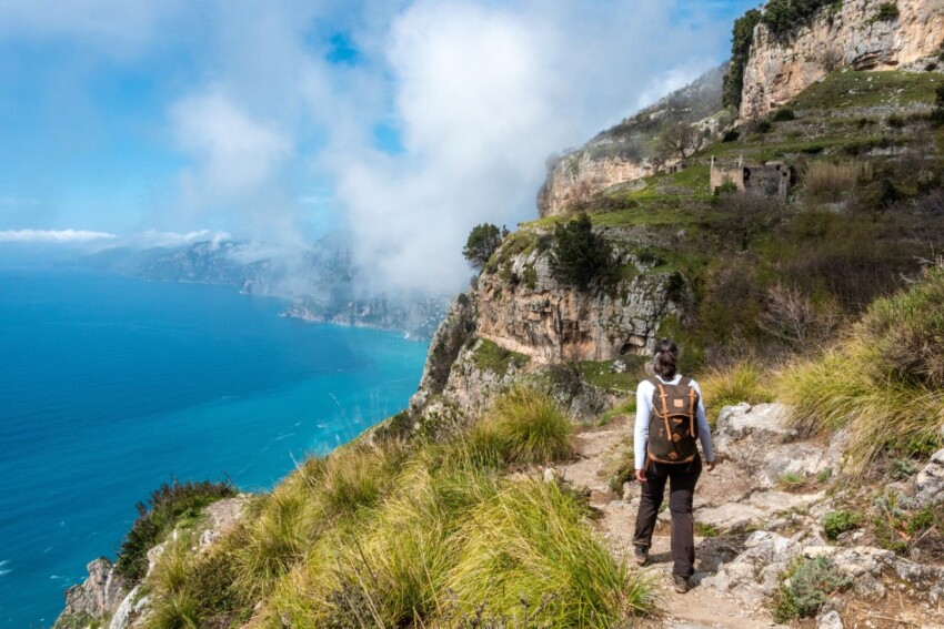
The Path of the Gods is Campania’s most famous trek and one of Italy’s most celebrated: it connects the hamlet of Bomerano (in the municipality of Agerola) to the hamlet of Nocelle (in the municipality of Positano) along the south-eastern ridge of the Lattari Mountains at an average altitude of approximately 500 metres, within the Lattari Mountains Regional Park. The route winds across abandoned terraces, rocky crags, holm oak woods and dense macchia fragrant with rosemary, with the Gulf of Salerno, the Li Galli islands, Capri and the Sorrento Peninsula forming an unbroken backdrop.
For centuries it was the only link between Agerola’s shepherds, who descended to barter cheese and dairy products for the catch from Positano, and the sea below. Today it’s the trek that every hiking enthusiast puts on their list when visiting the Amalfi Coast.
The most frequently walked variant, the so-called lower path catalogued as CAI 327, starts from Piazza Paolo Capasso in Bomerano (620 metres altitude) and arrives at Nocelle (437 metres), with a descent of approximately 180 metres and some intermediate ups and downs. Throughout the entire route the signposting is excellent with CAI white-and-red waymarks and directional signs: it’s impossible to get lost.
Allow a minimum of 3–4 hours to complete it without rushing, including photo stops.
From Piazza Paolo Capasso you proceed south-west along a gently descending lane that passes the last houses of the village.
After about 300 metres you turn right to cross a wooden bridge that leads back to the road above, which you’ll walk along for several hundred metres before the actual footpath begins. The first few minutes of walking traverse the lemon terraces that characterise this upper part of the Coast: Amalfi lemons (the “Sfusato Amalfitano” variety with its thick fragrant skin) cling to dry-stone terraces that man has built on these slopes to carve out cultivatable space from the limestone rock.
The scent of spring blooms, combined with the sea air rising from below, is one of the first sensations that makes the start of the path memorable even before the views begin.
Near the 528–630 metre mark you’ll encounter the Biscotto Grotto: a natural cavity carved into friable limestone that gave the name to this hollow because of its characteristic crumbly walls – “biscotto” (biscuit-like) – so called for the material that fragments easily.
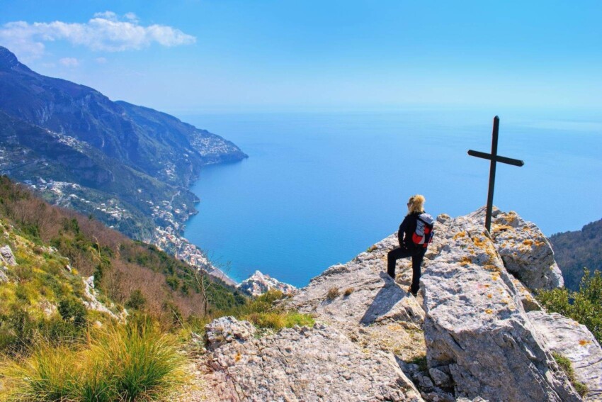
The grotto opens onto the path side with a small viewing terrace from which precipices can drop 200 metres and the gulf views are already extraordinary. Just beyond, on a limestone pinnacle, stands the plaque dedicated to Ettore Paduano, the member of the Naples section of the Italian Alpine Club who rediscovered and promoted this ancient shepherd’s path in the early twentieth century, naming it the “Path of the Gods”.
The inscription on the plaque reads: “Along this Path of the Gods, Ettore Paduano introduced many young members of the Naples section of the Italian Alpine Club to mountain walking”. At Colle Serra, just ahead, a fork divides the lower path (left, towards Nocelle) from the upper path (right, towards Monte Tre Calli): take the left fork.
Colle Serra (578 metres) is the convergence point where the path from Praiano (the alternative starting variant) joins, and where the vegetation changes radically and abruptly.
Up to here: lemons, vines, grass, terraces. From here onwards: the Mediterranean maquis in its densest and most fragrant form, with holm oaks, arbutus, tree heath, wild rosemary and broom.
In spring the blooms overlap in a palette of whites (heath), yellows (broom) and purples (rosemary) with a chromatic and olfactory intensity that few Mediterranean environments can match. In the deeper valleys, where moisture collects sheltered from the sun, ash trees and oak grow, creating stretches of shady, cool woodland that are particularly pleasant in summer.
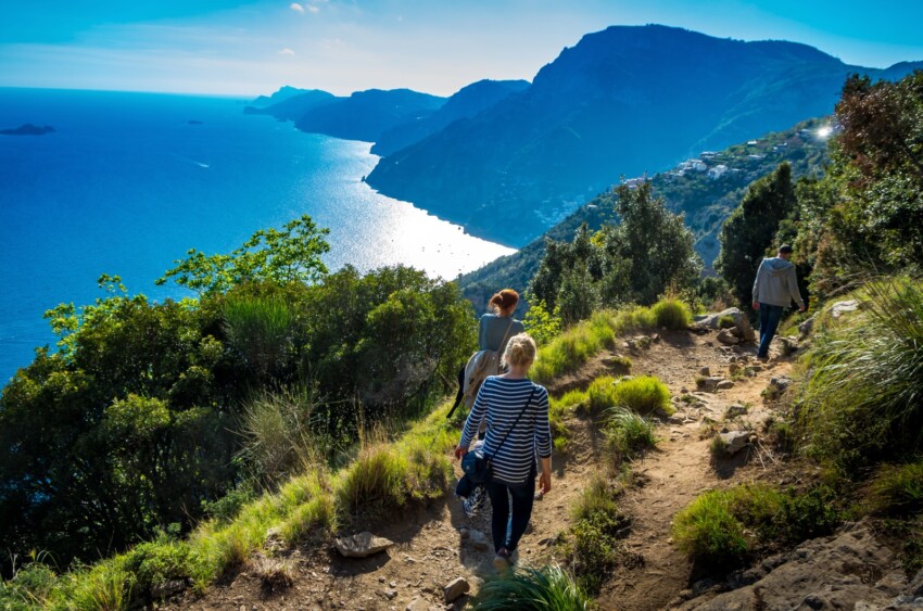
The section between Colle Serra and Nocelle is the most photographed and most famous part of the Path of the Gods: a long traverse at mid-slope, carved into the rock, where the path alternately widens and narrows, offering views over the gulf of almost unreal beauty.
Positano appears ever closer, the bell tower of the Church of Santa Maria Assunta with its majolica dome is recognisable from afar, and the sea beneath you changes colour from green to azure to turquoise depending on the depth and light. At some of the panoramic terraces equipped with wooden benches you can stop and gaze: to the south-west lie the Faraglioni stacks of Capri, closer by the Li Galli islands (the small archipelago that in Greco-Roman mythology was identified with the Sirens’ Islands), and to the east the profile of the Lattari Mountains extending towards Punta Campanella.
The peregrine falcon, which nests on the rocky walls of the Lattari, is a frequent companion on this section of path: spot it by its characteristic anchor-shaped silhouette in flight and the shrill cry with which it announces the presence of hikers.
The lower path ends at Nocelle, a small hamlet of Positano with about 150 inhabitants that for centuries was reachable only on foot via the staircase rising from Positano.
Nocelle has remained almost entirely outside the tourist flow that transformed the coastal villages: the houses are simple, the alleyways narrow, and the little piazza with its small church and an ancient centuries-old oak is a most pleasant stopping point.
The Chiosk of the Gods, the bar at the path’s end, serves lemon granitas, panini with Agerola products and cold drinks: a lemon granita upon arriving at Nocelle, with Positano’s panorama spread beneath you, is one of those simple yet perfect culinary moments you’ll remember for years.
From Nocelle you can descend to Positano in two ways.
The first is the staircase: approximately 1,500 stone steps that descend steeply to the State Road 163, from whose edge you walk for another 500 metres or so to the town centre. The descent takes about 30–40 minutes but is physically demanding for those already tired from the trek.
The second is the internal shuttle bus connecting Nocelle to central Positano: it runs roughly hourly, stopping near the piazza.
If you arrive at Positano in early afternoon you can enjoy the town at its most beautiful, lights beginning to twinkle on, day-trippers returning to ferries, and you can stop for dinner before heading back to your base.
Every path has a history of use predating tourism, and the Path of the Gods is no exception: for centuries it was the daily link between pastoral communities in Agerola and the coastal villages. Agerola shepherds descended to Positano and other coastal towns laden with cheeses, dairy products and produce from the Lattari Mountains (fiordilatte, provolone del monaco, pera pennata pear) and returned with fish, salt and the abundance that the sea produced.
It was a commercial route, an economic exchange that kept both economies alive. Traces of this use are still visible along the path in abandoned terraces, crumbling houses and water collection basins that mark the resting points of ancient walkers.
The name “Path of the Gods” is relatively recent but inspired by ancient tradition. It was Ettore Paduano, a hiker and member of the Naples section of the Italian Alpine Club founded by Giustino Fortunato, who rediscovered the route in the early twentieth century and christened it with this evocative name that draws directly from Greek mythology.
The legend behind the path’s name is connected to Homer’s Odyssey: the Li Galli islands, clearly visible from the path, were in classical tradition identified with the Sirenum Scopuli, the rocks where the Sirens, half-woman and half-bird in the original Greek version, later transformed into half-fish creatures in medieval tradition, laid their traps for sailors with irresistible song. Ulysses, who wanted to hear their song without perishing, had himself bound to the ship’s mast and ordered his sailors to plug their ears with wax. According to local legend, the Greek gods of Olympus, worried for the clever King of Ithaca, descended this very path to come to his aid. Hence the name that transforms an ancient shepherd’s mule track into a divine way.
A majolica ceramic plaque at the path’s start bears the words of Italo Calvino, one of many writers seduced by the beauty of this place: “Setting out precisely from the Path of the Gods, from that road suspended over the magical gulf of the Sirens, still traversed today by memory and myth”. It’s one of the most apt inscriptions in Italian hiking: these words alone explain why it’s worth walking it.
The Path of the Gods is a public nature trail within the Lattari Mountains Regional Park: access is completely free and requires no booking or ticket.
Anyone can walk it freely while respecting park regulations: no fires, no litter, no picking of plants or wildlife.
Those preferring professional guidance can contact the environmental hiking guides of AIGAE (Italian Association of Environmental Hiking Guides) or certified guides of the Lattari Mountains Park: guided excursions, available by booking, offer important added value for those wanting to understand the botany, geology and history of the route. Guided tour costs vary roughly between €40 and €80 per person depending on the operator and service duration.
The path has no opening or closing times: it can be walked at any time of day when weather conditions permit. In rain or when the ground is wet it’s inadvisable due to slipping risks on some stretches of bare rock. Always check the weather forecast before setting out.
Your choice of season and time of day significantly affects the quality of the experience, both in terms of physical conditions and crowds.
April, May and June are ideal months: perfect temperatures for walking (15–22°C), vegetation in full bloom, intense fragrance of broom and rosemary, excellent visibility over Capri and the islands. Crowds are present but manageable, especially on weekdays. Early morning (departing Bomerano by 8:00–8:30am) ensures the path is almost deserted for the first section.
September and October are equally valid: the sea is still warm (swimming possible at Positano after the trek), vineyards are in full harvest with typical autumn colours, temperatures drop to comfortable levels after summer. The path is far less crowded than in spring.
November and March are transitional months: generally passable with stable fine weather, but with shorter days and greater possibility of weather variability.
July and August require caution: the path is heavily exposed to sun for most of the route, midday temperatures often exceed 35°C, and on summer weekends the number of hikers turns it into a procession that erases the “mystical” atmosphere described by Calvino. If you visit the Coast in summer and want to walk the path, start at dawn (6:00–6:30am) when temperatures are still cool and the panorama in the soft morning light is extraordinary. Don’t walk during the heat of the day.
Monday is statistically the least crowded day of the week; spring Saturdays are the busiest. On national holidays the path can become impassable due to crowds.
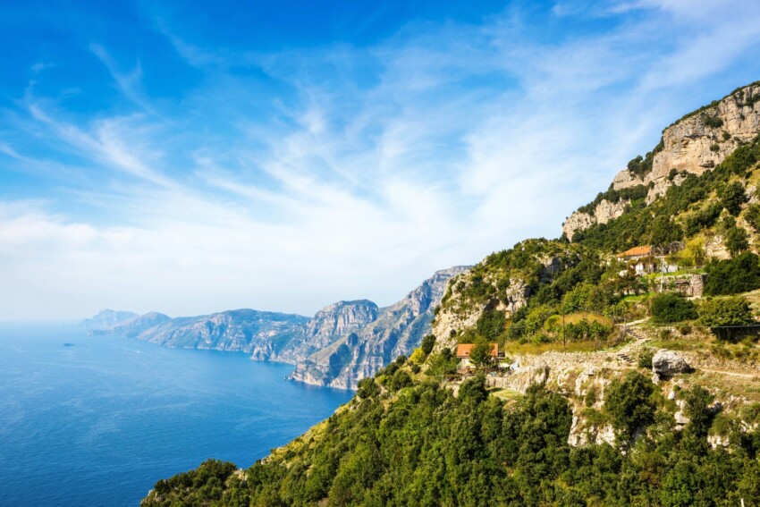
The lower trail (Bomerano → Nocelle) is the route taken by 95% of visitors, but it’s not your only option.
The upper trail also starts from Bomerano but climbs rather than descends, reaching Monte Tre Calli at 1,111 metres elevation (nearly double the altitude of the lower trail) and finishing at Santa Maria del Castello, a district of Vico Equense.
It’s a significantly more demanding route, with greater uphill elevation gains and a wilder, more solitary setting. The views are different: from below you see the coastline, while from above you see the interior of the Lattari Mountains, with the Apennines visible in the distance on clearer days. The higher elevation offers cooler conditions even in summer.
It suits experienced hikers looking for solitude and inland scenery rather than sea views.
Starting from Praiano, you climb a flight of steps to Colle Serra (580 metres), where you meet the lower trail coming from Bomerano.
The route takes around 40–50 minutes of fairly strenuous climbing before joining the main trail. The advantage is that you start directly from the coast without needing to catch a bus to Agerola, and the path passes near the Convent of San Domenico (16th century) on the variation that climbs from Vettica Maggiore. This is useful if you’re staying in Praiano or Positano and want to avoid the transfer to Bomerano.
If you still have energy when you reach Nocelle, you can continue towards Montepertuso, another district of Positano famous for the large natural arch cut through the rock, the “hole” that gives the place its name—pertuso in Neapolitan dialect. Local legend says the opening in the rock was made by the Madonna, who hurled the devil against the cliff face.
From Montepertuso you descend to Positano via another flight of steps with roughly 300 metres of elevation loss.
The easiest and most environmentally friendly way to reach the starting point is by SITA Sud bus from Amalfi: the first service from Piazza Flavio Gioia departs at 7:10, the journey takes roughly 40 minutes and costs around €2. Ask the driver for the Bomerano stop (Piazza Capasso).
Amalfi is easily reached by Travelmar ferries from Salerno, Sorrento and Positano (seasonal, April–October). If you’re travelling from Positano, allow around 2 hours including transfers; from Sorrento, roughly 3 hours.
From April to October, Travelmar offers a combined ferry plus shuttle service: the shuttle departs from Amalfi timed with ferry arrivals from Salerno and takes you directly to Piazza Capasso in Bomerano. It’s the most convenient option for those arriving by sea.
If you’re driving, there are two main routes. From the northern side: the A3 motorway to Castellammare di Stabia, then the SS366 towards Gragnano, Lettere and Agerola. From the southern side: the SS163 Amalfitana to Vettica Minore near Praiano, then a winding uphill road (11 km) to Bomerano.
Parking is available on the white lines near the square (free) or at the paid car park near Agerola stadium (around €5 per day). Driving on these roads requires experience navigating narrow, winding routes; in high season the bus is preferable.
Arranging your return is the most logistically challenging part of the hike: the trail isn’t a loop and getting back takes time.
The typical sequence is:
Allow at least 2–3 hours for the return, accounting for waiting times and possible traffic on the Coast during weekends. Alternatively, a private taxi or car service from Positano or Nocelle to Agerola is faster but considerably more expensive.
The right equipment makes the difference between a pleasant hike and a tiring or dangerous one.
Trekking shoes with anti-slip soles and ankle support are essential: sandals, smooth trainers or gym shoes won’t do. The trail has sections of exposed rock, irregular steps and loose stones that require a sole with proper grip.
Carry at least 1.5 litres of water per person: water sources along the route are sparse and not always accessible; the only reliable refill points are the bar at Bomerano before you start and the Chiosco degli Dei at Nocelle. Sun protection is vital because of prolonged sun exposure on the central section. A lightweight windproof jacket is advisable even in summer for the windy stretches at height.
The trail isn’t suitable for children under 8–10 years old because of exposed sections without railings and the overall length. Adults with vertigo should also consider carefully: some points offer vertical views of the sea with no protection, and the sense of exposure can be intense.
The Park formally advises against the trail for those with heart conditions or high blood pressure. Trekking poles are useful for the descent, which puts strain on the knees.
The classic route (lower trail, Bomerano → Nocelle) is 7.8 kilometres in one direction. If you add the walk down from Nocelle to Positano, the total exceeds 10 kilometres. The upper variant is longer with greater elevation gain.
The Regional Park of the Lattari Mountains indicates a walking time of 4 hours for the lower trail. In practice, someone walking at a moderate pace and stopping for photos reaches Nocelle in 3–4 hours. Fast walkers can do it in 2.5 hours. Then allow an extra 30 minutes for the walk down to Positano, or the time to wait for the shuttle bus.
The Park classifies it as E (escursionistico)—technically easy, but with exposed sections. The official assessment assumes reasonable fitness and appropriate footwear. Those who don’t walk regularly or have no mountain-trail experience might find some sections challenging, especially in summer heat.
It’s never technically difficult in the mountaineering sense, but the combination of length, sun exposure and exposed sections demands respect.
Technically yes, but it’s heavily advised against: doing it in reverse, the trail becomes almost entirely uphill, more exhausting and less scenic (you’re looking at your own back instead of the sea). Nearly all visitors choose the Bomerano → Nocelle direction for good reason: this is the direction in which the view progressively “opens up” and you walk downhill with the sea before you.
Water sources along the path are sparse and not always available: don’t rely on them. Stock up on water at Bomerano before you start (at least 1.5 litres per person) and top up at the Chiosco degli Dei at Nocelle. In summer, dehydration is a real risk for those who don’t carry enough water.
With children aged 10–12 and above who are used to mountain walking, it’s possible, but it requires preparation and attention. Exposed sections without railings need constant supervision. For younger children it’s not recommended: the length (nearly 8 km), the presence of sheer drops and summer heat aren’t suitable for small children.
There are shorter, less exposed alternative trails in the surroundings of Amalfi (Valle delle Ferriere) and Ravello (Sentiero dei Limoni towards Minori) that are better suited to families.
Agerola and Bomerano offer some quality accommodation that allows you to start the trail directly from your door early in the morning, avoiding the 7:10 bus from Amalfi. It’s the ideal solution if you want to walk the trail in complete peace during the early morning hours.
 Hotel
Hotel  Budget accommodations
  Apartments
  Family Hotel
  Luxury Hotel
  Resorts