Pompeii: Entry Ticket with Audio Guide
13.560 reviews
Buy now
From 34,50€ per person
 Airport
 Port
Port Attraction
 Street / Square
 District
If you’re planning a trip to Naples, the interactive map on this page will help you find all the places of interest we recommend visiting, as well as other useful travel points such as the airport or Naples port. Simply click on the markers on the map, or in the list just below, to access detailed information about each point of interest.
The City of Naples has produced maps showing the city’s main points of interest and transport links. Click on the previews below to enlarge, download or print them.
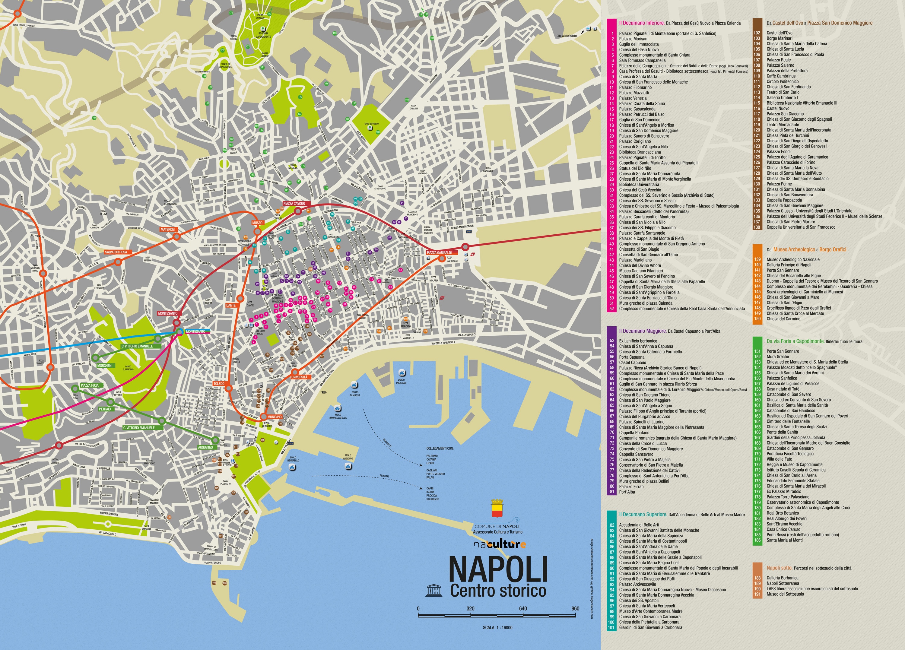
Essential for any visitor, the Historic Centre map is invaluable for planning your itinerary to discover the finest attractions in Naples.
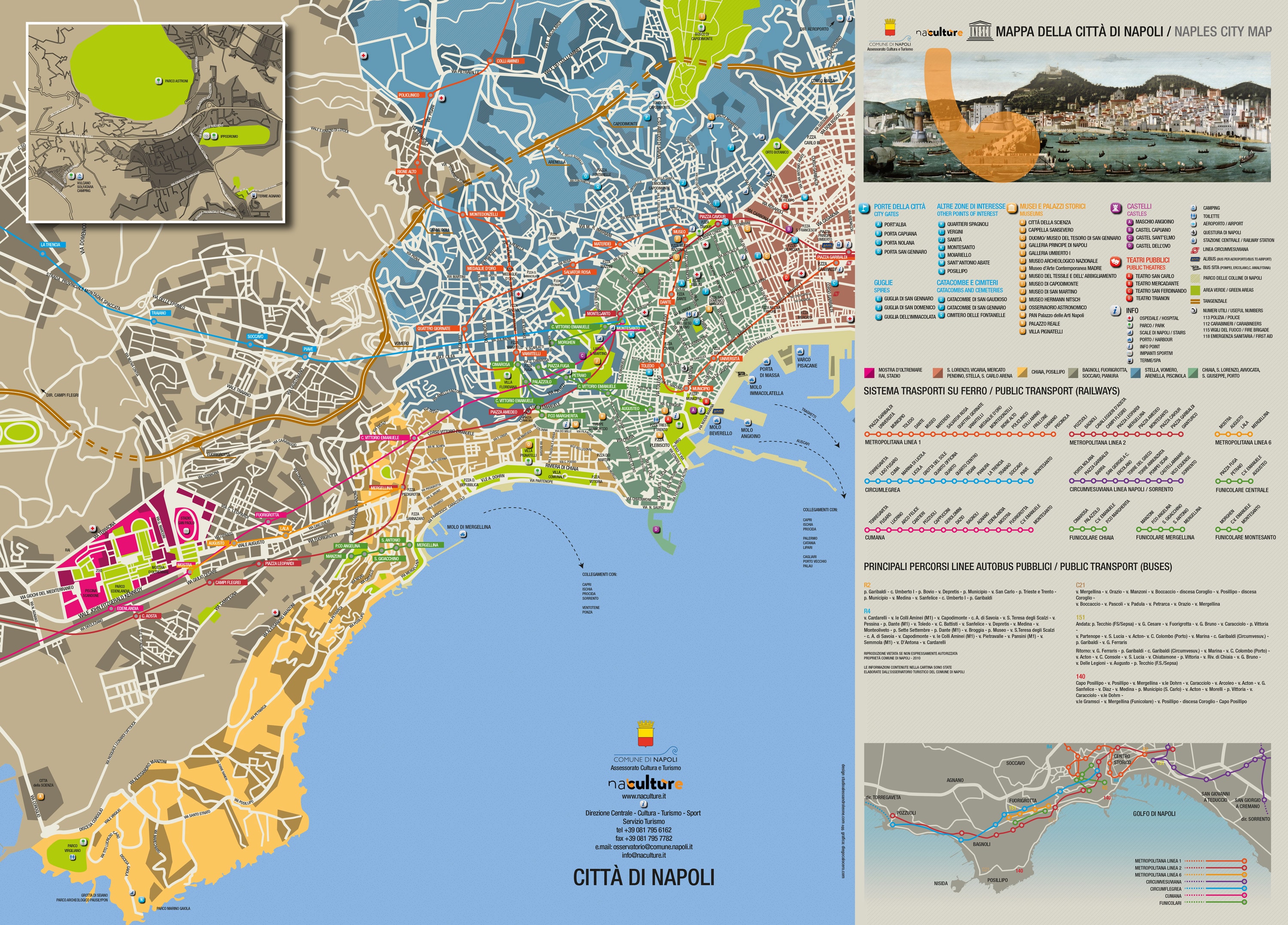
Below is the map of Naples transport showing the metro lines and public bus routes ideal for tourists, to reach the city’s main attractions easily and conveniently.
You can also download the complete PDF map of the Naples metro lines directly from the dedicated page or by clicking the button below.
Metro map in PDFNaples is the capital of Campania and Italy’s third most populous city with approximately one million inhabitants, after Rome and Milan. The city sits on the Gulf of Naples, south of Mount Vesuvius.
 Hotel
Hotel  Budget accommodations
  Apartments
  Family Hotel
  Luxury Hotel
  Resorts